Sextant Session
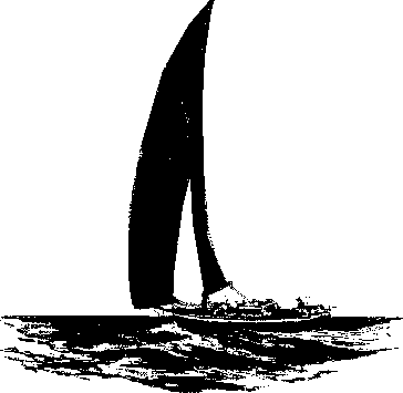 Time to get ready to shoot the stars and find out just where we are. PreparationsHaving kept a good log we have a deduced reckoning of 31° 54' South and 15° 39' East. It is December the first 2000 - and we know that twilight will begin around 1900 hours UT. Having done a spot of checking we know that there will be a crescent moon overhead, various planets - Venus will blaze away in the West - and some nice bright stars. The Moon and planets introduce some complexity into navigation so, being lazy, I have decided to ignore the Moon and her planetary retinue and stick to the stars.Now we get our trusty sextant out of its case, and slipping the lanyard over our heads (it is a delicate and expensive instrument so we would not wish it to fall overboard), we set the clamp to zero and look at the horizon. Mmmm. Not level. Split, as usual. We fiddle with the micrometer knob until the horizon is level. 1.2' - and its "off the arc". Thus it must be added to our star heights. We do the exercise again just to be sure - yes we were right first time +1.2' is our Index Error. As we stand in the welldeck our eye is 2.2 metres above sea-level. That's 7 foot 2.5 inches for those still using Imperial measure. Thus our Dip is 2.6'. Dip is always subtracted. Thus we have a combined correction of dip and index error amounting to 1.2 - 2.6 = 1.4'. And it must be subtracted from our sextant altitude. We now prepare a page in our notebook. The first line reads: Date, Dead Reckoning position, course and speed. Just so we do not forget. I.XII.2000 - DR 31° 54' S 15° 39' E. Course 188 T. Speed 4 knots. I have a copy of the sight reduction tables and these give me a good idea of which prominent navigation stars will be visible. I select the ones I hope to shoot and write them down: *CANOPUS * FOMALHAUT *ACHERNAR *HAMAL *PEACOCK. And leaving two blank lines for our time and observed altitude we write down our combined index error and dip correction under each star. Our notebook page now looks like this:
Shooting the StarsNow we are ready - and yes a few of the big ones are visible. We wear a digital watch on our left arm, face against the pulse where it is nicely visible while we fiddle with the micrometer knob. It is set to UT or Greenwich Mean Time and is accurate, by radio, to within a second. We have a small torch handy to read the micrometer knob, a pen, our trusty notebook and of course the sextant.
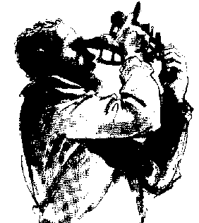 Canopus is winking away in the South. It's the work of seconds to find her in the telescope and bring her down to brush the horizon. A few more fiddling with the micrometer and we have her. Instantly our eye shoots to the watch - which is facing us and we immediately note the seconds. Then minutes and hours. We write these down in the column we have made for Canopus. Then we look at the sextant altitude and write that down too.

After we have shot all our stars our notebook page looks like this:
Working it all outWe can now pack our sextant away in its box and leave it there till the morning. We get out the Nautical almanac and prepare to do mathematical battle.Firstly we find, from the almanac, the refraction - and this is always subtracted.
Subtracting our combined dip and index error plus the refraction we arrive at our Observed Altitude.
Notice how my stars are fairly high and spread out from each other. The ideal is stars of about 45° altitude, being placed at about 120° from each other to give good angles of "cut" on the intercepts. To obtain our TZD - that's True Zenithal Distance we subtract our Observed Altitude from 90. This gives us the distance to the zenithal point of each star.
Going into the Nautical Almanac I extract the SHA for each star and it's declination. Working out the GHA of Aries for each starsight time I can then find the GHA of each star by adding the two to find out how far west of the Greenwich line each star is.
Into the Spherical TrigNow we have all the information we need to solve for the spherical triangle APB. To obtain the leg PA from the pole to the zenithal point of the star we use the declination and to obtain the angle P we use the GHA and our deduced longitude. The leg PB we obtain from our DR position.Our "solution table" looks something like this.
Next I determine, by spherical trigonometry the Calculated Zenith Distance and azimuth of the body.
Our actual intercepts and bearings looked like this:
Choosing the scale for the rough work. Normally one would choose a scale that is the same as that of the largest scale chart of the area in one's possession so that when it comes to transfer the position to the fair chart things are made easier. However if one is in a lonely bit of ocean in the middle of nowhere then that scale would probably be too small. In such instances it is usual to use a scale that would show about a degree either way of ones DR position. Of course if the intercepts are showing some really large numbers one would have to adjust the scale accordingly. In the following example I have chosen an unrealistic scale - one too large for most real situations because one would seldom get the position lines so obligingly close to each other. And our rough working looked like so: (ignoring the inaccuracies of the graphics package)

After transferring our position lines towards Peacock (remember we were moving South - on a bearing of 188 degrees true - at 4 knots while we were shooting our stars, our rough work looks like so. It's not often one would get a neat cross from a yacht, indeed from any vessel. Mostly one ends up with a "cocked hat". Or in this case a number of them! In which case we would take the centre as our position. If we were close to land or in doubt we would take the intersection nearest danger as our position.

After some struggling with the sums and pencil and paper our position works out to 31° 55.5' South and 15° 37.9' East. At 19:18:51 UT. We are within a couple of miles or so of our DR position. The whole exercise took 11 minutes and seventeen seconds of time to shoot the stars and another 10 or so working out the maths. Using the largest scale chart of the area that I possess, I make a small pencil mark of my position and add the time and date. I also enter the data in my deck log.

Crack open a cold one!Now its time to relax - we know where we are, we are more than 100 nautical miles away from the nearest land and heading away from it, so we should run into nothing terrestrial during the night.And we have to be up early in the morning to do the whole exercise again.
|
||||||||||||||||||||||||||||||||||||||||||||||||||||||||||||||||||||||||||||||||||||||||||||||||||||||||||||||||||||||||||||||||||||||||||||||||||||||||||||||||||||||||||||||||||||||||||||||||||||||||||||||||||||||||||||||||||||||||||||||||||||||||||||||||||||||||||||||||||||||||||||||||||||||||||||||||||||||||||||||||||||||||||||||||||||||||||||||||||||||||||||||||||||||||||||||||||||||||